CHEMICAL AND RADIOLOGICAL REMEDIATION
Industry: Manufacturing
Location: Northeast
Multi-phase remediation and restoration creates pond, wetlands, and walking trails
ENTACT is leading an extensive ecological restoration of more than 100 acres at a former industrial site that hosts several chemical manufacturers, a clay mining operation, and a disposal area for impacted soils and dredge spoils. The restoration plan aims to create a 14-acre open-water pond, 40 acres of wetland mitigation, 55 acres of upland enhancement, and nearly two miles of public walking trails and boardwalks. The project comprises multiple phases, detailed below:
Sediment Remediation Phase
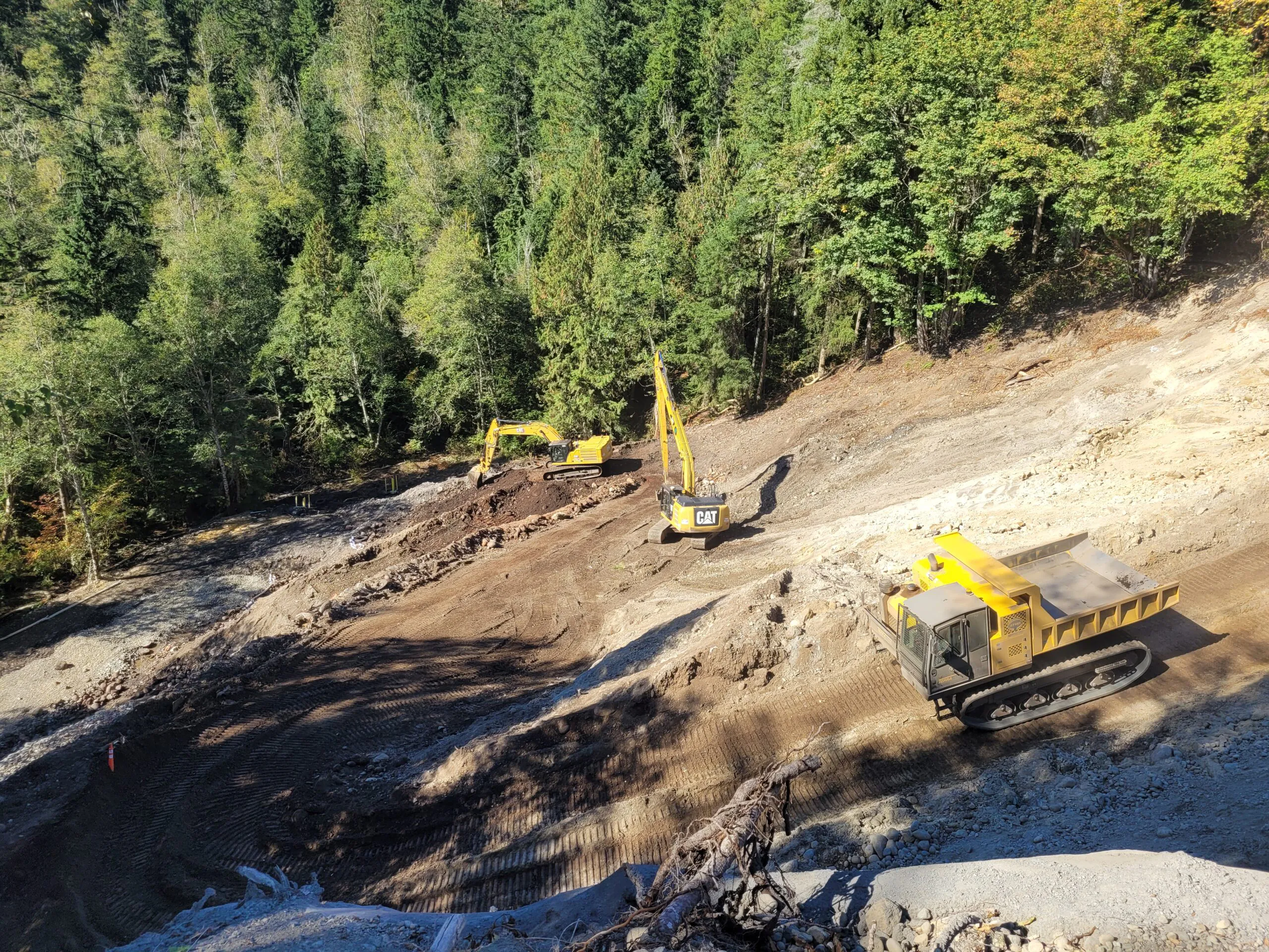
This phase focused on remediating impacted sediments from a five-acre lake, addressing contaminants such as benzaldehyde, bis (2-ethylhexyl) phthalate (BEHP), formaldehyde, and PCBs. The sediments varied in depths and were underlain by denser sands and clays. During the sediment remediation phase, ENTACT:
- Drained and dewatered the lake
- Constructed and operated a temporary water treatment system
- Removed 30,000 cubic yards of contaminated sediment
- Prepared the on-site consolidation area
- Constructed a four-acre surface cover over the consolidation area
- Imported 3,600 cubic yards of cap fill
- Placed 3,600 cubic yards of topsoil and vegetation
- Performed mitigation, seeding, and planting in disturbed areas, wetlands, and upland regions
- Installed permanent stormwater features, including conveyance channels and aprons in the encroachment area and a concrete headwall in the lake
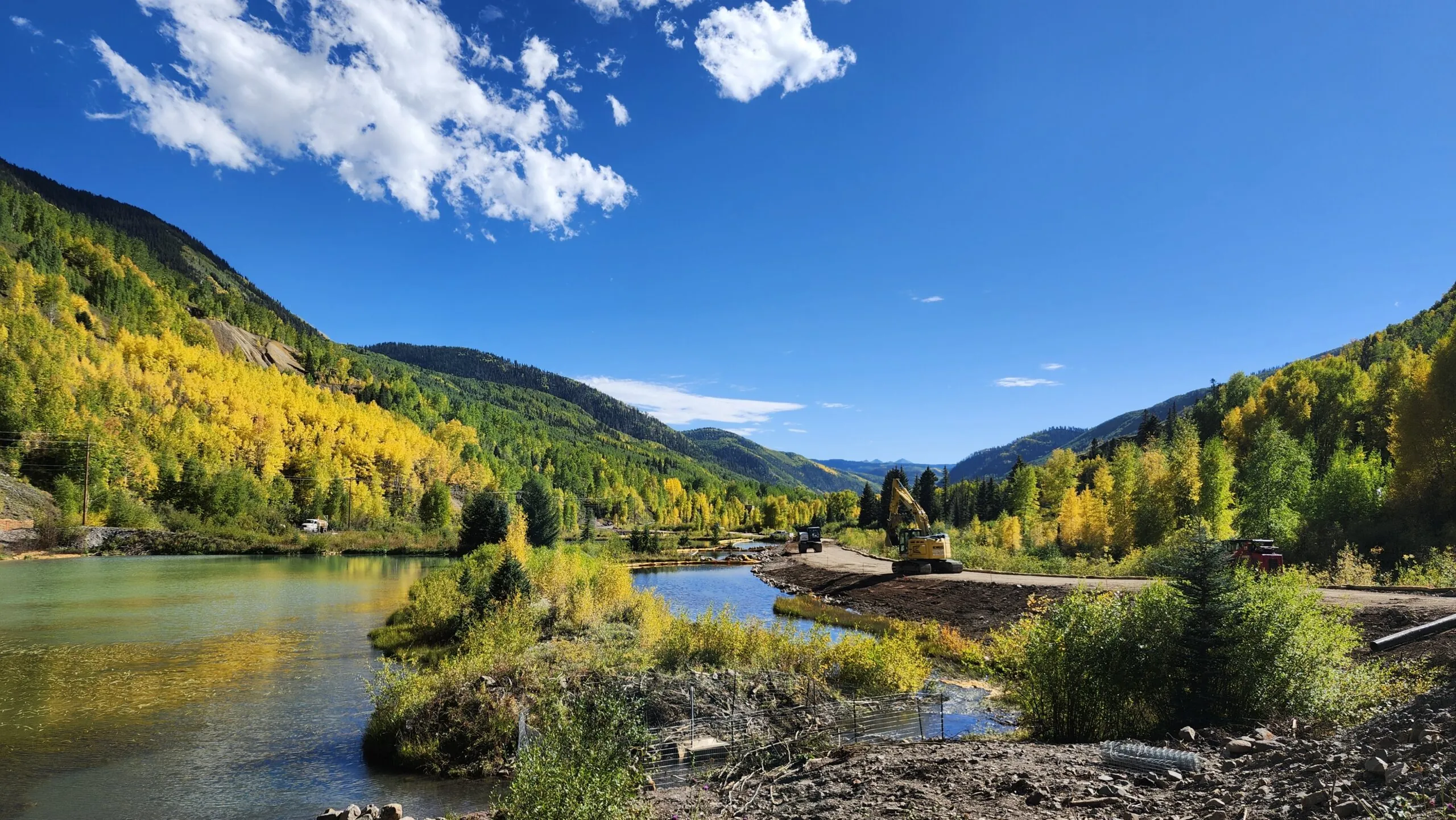
Soil Remediation and Wetland Restoration Phase
This phase targeted 23 acres impacted by VOCs, SVOCs, PCBs, pesticides, metals, and radiological waste (Ra-226, Th-232, and U-238). In this phase, ENTACT:
- Assembled and operated a water pre-treatment and storage system
- Targeted excavation of visually observed non-aqueous phase liquids (NAPL) impacted soil and sediment
- Installed a barrier wall system using steel sheet piling, connected to existing structures
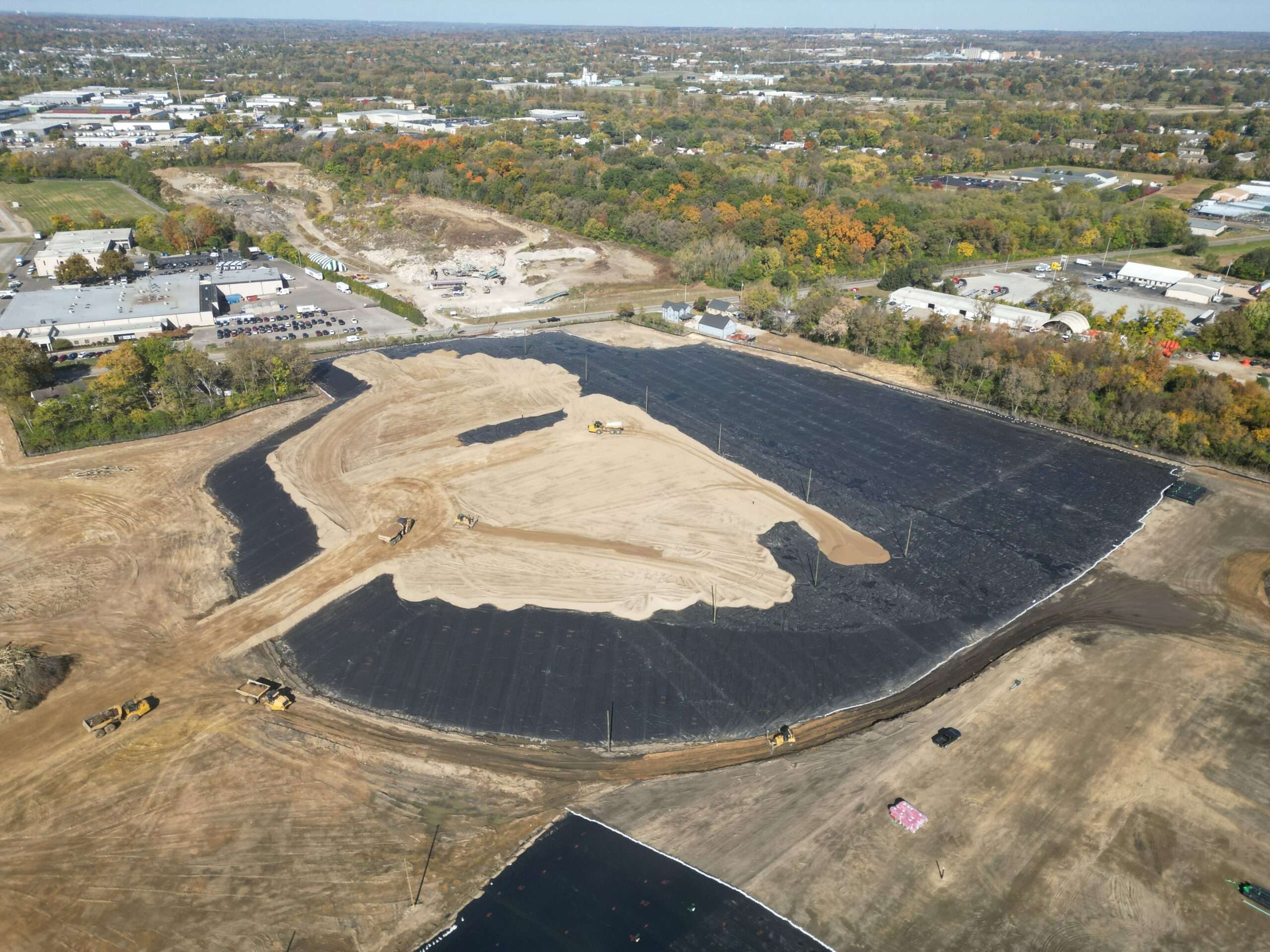
- Prepared subgrade, including cutting/filling and material handling prior to the installation of soil upland surface covers and a low permeability geosynthetic cap
- Installed a surface cover and low permeability cap systems
- Installed NAPL recovery wells, a barrier wall, wetland piezometers, and amendment application wells
- Performed waste and material management, including off-site transportation and disposal
- Completed wetland restoration and mitigation
- Installed permanent stormwater measures
Upland Remediation Phase
During the upland remediation phase, ENTACT focused on the western uplands, completing the following key scope tasks. Our team:
- Placed cap fill material and topsoil within the forest land use area
- Base grading and consolidation of excess soils
- Restored wetland areas, including removal of fill materials, wetland surface cover application, invasive species management, reseeding, and planting to enhance upland and riparian habitats
Infrastructure and Habitat Development Phase
The infrastructure and habitat development phase encompassed the construction of:
- Paved and gravel access roads, parking, and turn-around areas
- A trail network featuring stone and asphalt paths, public gathering areas, and bird blinds
- Boardwalks and overlook platforms, along with comprehensive site restoration
ENTACT also managed the radiological activities, coordinating with state regulators to establish project scope, applicable radiological release criteria, and the operation of an onsite radiological laboratory. During the project, our teams:
- Established a radiation safety program and fully staffed radiological laboratory onsite
- Excavated a two-acre uranium-impacted area and shipped 6,000 tons of soil offsite for disposal at an RCRA subtitle C facility
- Reused 45,000 tons of lightly impacted uranium soil onsite
- Characterized adjacent TENORM-impacted wetlands to depths of 16 feet, with all activities monitored and managed
MARSSIM-based surveys are being used to demonstrate compliance with release criteria, and delicensing of the property is expected in Summer 2026.
Let’s work together
We want to hear about your project. Learn how we
deliver results with innovation.
